| PANDEMIC ALERT LEVEL |
| 123456 |
| Tracking the next pandemic: Avian Flu Talk |
What Does NOAA (& others ) Say About The Weather? |
Post Reply 
|
| Author | ||
Mary008 
V.I.P. Member 

Joined: June 22 2009 Status: Offline Points: 5769 |
 Post Options Post Options
") Thanks(0) Thanks(0)
 Quote Reply Quote Reply
 Topic: What Does NOAA (& others ) Say About The Weather? Topic: What Does NOAA (& others ) Say About The Weather?Posted: October 26 2010 at 11:06am |
|
|
.Author Igloowiki,http://en.wikipedia.org/wiki/File:IcebergTwilightIllulissat.JPG
 What
Does
NOAA
Say About The Weather?
........................
Mary008
|
||
 |
||
|
Mary008
V.I.P. Member
Joined: June 22 2009 Status: Offline Points: 5769 |
Post Options
Thanks(0)
Quote Reply
Posted: October 26 2010 at 11:07am |
|
|
.
McClatchy
......................
NOAA: Warming Arctic Unlikely to Return to How it Was October 21, 2010
...New observations this year about snow, ice and temperatures support the conclusion
that the Arctic is unlikely to return to the conditions known in the 20th century
............................
Mary008
|
||
|
||
|
Mary008
V.I.P. Member
Joined: June 22 2009 Status: Offline Points: 5769 |
Post Options
Thanks(0)
Quote Reply
Posted: October 26 2010 at 11:14am |
|
|
. Snow falls in Yorkshire - In October!.................
Mary008
|
||
|
||
|
Mary008
V.I.P. Member
Joined: June 22 2009 Status: Offline Points: 5769 |
Post Options
Thanks(0)
Quote Reply
Posted: October 26 2010 at 11:21am |
|
|
.http://en.wikipedia.org/wiki/File:Chicago-night-sky.jpg kelly martin
 Bloomberg
.....................
Chicago Storm ...................................... May Beat 1975 Gale That Doomed Edmund Fitzgerald ...................................................................................................................... By Brian K. Sullivan - Oct 25, 2010 6:46 PM ET
A storm stronger than the one that sank the freighter Edmund Fitzgerald in 1975 is
expected to slash across the Midwest tomorrow, snarling Chicago travel and whipping
waves as high as 30 feet across Lake Michigan.
........................
Mary008
|
||
|
||
|
Mary008
V.I.P. Member
Joined: June 22 2009 Status: Offline Points: 5769 |
Post Options
Thanks(0)
Quote Reply
Posted: October 26 2010 at 11:28am |
|
 http://www.vg.no/nyheter/innenriks/artikkel.php?artid=10025579Snofast bilist: - Vi kommer ikke av flekkenNORWAY
PHOTO
in english...
from...
Snow chaos - Worst ever road situation in Norway - 21 Oct 10 - On the E39 at Vikeså east of Rogaland, police Thursday were stopping vehicles with summer tires. Surprised trailer operators were still driving with summer tires, and both cars and trucks were stuck in the hills in long queues waiting for snow crews. |
||
|
||
|
Mary008
V.I.P. Member
Joined: June 22 2009 Status: Offline Points: 5769 |
Post Options
Thanks(0)
Quote Reply
Posted: October 26 2010 at 11:44am |
|
|
.
Something they don't usually see in Arizona?
.............................................................................
Arizona Tornado Derails Train!
VIDEO
Tempe Mesa Arizona Tornado Looking east heading toward north Tempe
video
....................
Mary008
.
|
||
|
||
|
Mary008
V.I.P. Member
Joined: June 22 2009 Status: Offline Points: 5769 |
Post Options
Thanks(0)
Quote Reply
Posted: October 26 2010 at 11:48am |
|
|
.
Areas around CHICAGO BATTERED
................................................................................................................
They cal it...
A Wind Storm
........................
PHOTOS
........................
Mary008
|
||
|
||
|
Mary008
V.I.P. Member
Joined: June 22 2009 Status: Offline Points: 5769 |
Post Options
Thanks(0)
Quote Reply
Posted: October 26 2010 at 11:56am |
|
Tornado Reported In Peotone; Many WarningsOctober 26, 2010 7:12 AM UPDATED 10/26/10 8:56 a.m. ..........................
Mary008 |
||
|
||
|
Mary008
V.I.P. Member
Joined: June 22 2009 Status: Offline Points: 5769 |
Post Options
Thanks(0)
Quote Reply
Posted: October 26 2010 at 11:59am |
|
|
.
Tornadowarning in Kane County as storm front hits
October 26, 2010 7:06 AM
.......................
Mary008 |
||
|
||
|
Mary008
V.I.P. Member
Joined: June 22 2009 Status: Offline Points: 5769 |
Post Options
Thanks(0)
Quote Reply
Posted: October 26 2010 at 12:14pm |
|
|
||
|
Mary008
V.I.P. Member
Joined: June 22 2009 Status: Offline Points: 5769 |
Post Options
Thanks(0)
Quote Reply
Posted: October 28 2010 at 8:11pm |
|
|
.
Iceland Volcano
It was
Massive .................... Iceland Volcano Grounds UK Flights Volcanic Ash Sweeps Into British Airspace Closing Airports NASA satellite image of Iceland volcano ash plume over Europe
wow...
Iceland Volcano - Incredible Up Close Volcano Eruption Iceland April 2010
Volcano Eruption in Iceland Fimmvörðuháls "Nice sound"
....................
Mary008
|
||
|
||
|
Mary008
V.I.P. Member
Joined: June 22 2009 Status: Offline Points: 5769 |
Post Options
Thanks(0)
Quote Reply
Posted: October 28 2010 at 8:46pm |
|
|
.
Forecasters say this winter could be the coldest Europe has seen in the last 1,000 years. VIDEOCalving Glacier *DANGER*
......................
Mary008
|
||
|
||
|
Mary008
V.I.P. Member
Joined: June 22 2009 Status: Offline Points: 5769 |
Post Options
Thanks(0)
Quote Reply
Posted: November 08 2010 at 5:27pm |
|
|
.
This info is facinating... try to read it bit by bit... well worth it.
Lyall Glacier, North Cascades with 1966 map outline
and SPOT satellite image overlay from 2005.
A new lake has formed and the glacier is gone
Recent Global Glacier Retreat OverviewPHOTOS
..................
Mary008
|
||
|
||
|
Mary008
V.I.P. Member
Joined: June 22 2009 Status: Offline Points: 5769 |
Post Options
Thanks(0)
Quote Reply
Posted: November 20 2010 at 4:23pm |
|
|
.
Coming to the East in a few days....
From NOAA
..........................
000
WWUS43 KMPX 202104 WSWMPX URGENT - WINTER WEATHER MESSAGE NATIONAL WEATHER SERVICE TWIN CITIES/CHANHASSEN MN 304 PM CST SAT NOV 20 2010 ...LIGHT FREEZING RAIN AND DRIZZLE ARE LIKELY TONIGHT IN EAST CENTRAL MINNESOTA AND WEST CENTRAL WISCONSIN... .A FREEZING RAIN ADVISORY HAS BEEN ISSUED FOR LATE TONIGHT AND SUNDAY MORNING FOR THE TWIN CITIES METROPOLITAN AREA AS WELL AS ALL OF WEST CENTRAL WISCONSIN. MINOR ICE ACCUMULATIONS...UP TO A TENTH OF INCH...ARE EXPECTED IN PORTIONS OF EAST CENTRAL MINNESOTA AND WEST CENTRAL WISCONSIN. THE BEST CHANCE FOR THE MINOR ICE ACCUMULATIONS WILL BE NEAR OR TO THE EAST OF THE TWIN CITIES. ONLY A FEW HUNDREDTHS OF AN INCH IS EXPECTED IN MANY LOCATIONS...BUT THIS WILL BE ENOUGH TO MAKE SIDEWALKS AND ROADWAYS SLICK. TEMPERATURES SHOULD WARM ABOVE FREEZING BY THE NOON HOUR ON SUNDAY AND REDUCE THE ICE THREAT. MNZ052-053-060>063-070-078-WIZ014>016-023>028-210515- /O.NEW.KMPX.ZR.Y.0003.101121T0900Z-101121T1500Z/ ISANTI-CHISAGO-HENNEPIN-ANOKA-RAMSEY-WASHINGTON-DAKOTA-GOODHUE- POLK-BARRON-RUSK-ST. CROIX-PIERCE-DUNN-PEPIN-CHIPPEWA-EAU CLAIRE- INCLUDING THE CITIES OF...CAMBRIDGE...CENTER CITY...MINNEAPOLIS... BLAINE...ST. PAUL...STILLWATER...BURNSVILLE...RED WING...AMERY... BALSAM LAKE...RICE LAKE...BARRON...LADYSMITH...HUDSON... NEW RICHMOND...RIVER FALLS...PRESCOTT...MENOMONIE...BOYCEVILLE... DURAND...PEPIN...CHIPPEWA FALLS...BLOOMER...EAU CLAIRE...ALTOONA 304 PM CST SAT NOV 20 2010 ...FREEZING RAIN ADVISORY IN EFFECT FROM 3 AM TO 9 AM CST SUNDAY... THE NATIONAL WEATHER SERVICE IN TWIN CITIES/CHANHASSEN HAS ISSUED A FREEZING RAIN ADVISORY...WHICH IS IN EFFECT FROM 3 AM TO 9 AM CST SUNDAY. * TIMING...LIGHT FREEZING RAIN AND FREEZING DRIZZLE SHOULD SPREAD INTO FAR SOUTHERN MINNESOTA AFTER MIDNIGHT...WITH LIGHT ICE ACCUMULATIONS OCCURRING BETWEEN 3 AM AND 9 AM CST SUNDAY. * ICE ACCUMULATIONS...FROM A COUPLE HUNDREDTHS UP TO A TENTH OF AN INCH. * OTHER IMPACTS...SIDEWALKS AND ROADWAYS COULD BECOME SLIPPERY TONIGHT AND SUNDAY MORNING. BRIDGES AND OVERPASSES ARE ESPECIALLY SUSCEPTIBLE TO MINOR ICE ACCUMULATIONS. PRECAUTIONARY/PREPAREDNESS ACTIONS... A FREEZING RAIN ADVISORY MEANS THAT PERIODS OF FREEZING RAIN OR FREEZING DRIZZLE WILL CAUSE TRAVEL DIFFICULTIES. BE PREPARED FOR SLIPPERY ROADS. SLOW DOWN AND USE CAUTION WHILE DRIVING. && $$ FRANKS 000 WWUS43 KMPX 202104 WSWMPX URGENT - WINTER WEATHER MESSAGE NATIONAL WEATHER SERVICE TWIN CITIES/CHANHASSEN MN 304 PM CST SAT NOV 20 2010 ...LIGHT FREEZING RAIN AND DRIZZLE ARE LIKELY TONIGHT IN EAST CENTRAL MINNESOTA AND WEST CENTRAL WISCONSIN... .A FREEZING RAIN ADVISORY HAS BEEN ISSUED FOR LATE TONIGHT AND SUNDAY MORNING FOR THE TWIN CITIES METROPOLITAN AREA AS WELL AS ALL OF WEST CENTRAL WISCONSIN. MINOR ICE ACCUMULATIONS...UP TO A TENTH OF INCH...ARE EXPECTED IN PORTIONS OF EAST CENTRAL MINNESOTA AND WEST CENTRAL WISCONSIN. THE BEST CHANCE FOR THE MINOR ICE ACCUMULATIONS WILL BE NEAR OR TO THE EAST OF THE TWIN CITIES. ONLY A FEW HUNDREDTHS OF AN INCH IS EXPECTED IN MANY LOCATIONS...BUT THIS WILL BE ENOUGH TO MAKE SIDEWALKS AND ROADWAYS SLICK. TEMPERATURES SHOULD WARM ABOVE FREEZING BY THE NOON HOUR ON SUNDAY AND REDUCE THE ICE THREAT. MNZ052-053-060>063-070-078-WIZ014>016-023>028-210515- /O.NEW.KMPX.ZR.Y.0003.101121T0900Z-101121T1500Z/ ISANTI-CHISAGO-HENNEPIN-ANOKA-RAMSEY-WASHINGTON-DAKOTA-GOODHUE- POLK-BARRON-RUSK-ST. CROIX-PIERCE-DUNN-PEPIN-CHIPPEWA-EAU CLAIRE- INCLUDING THE CITIES OF...CAMBRIDGE...CENTER CITY...MINNEAPOLIS... BLAINE...ST. PAUL...STILLWATER...BURNSVILLE...RED WING...AMERY... BALSAM LAKE...RICE LAKE...BARRON...LADYSMITH...HUDSON... NEW RICHMOND...RIVER FALLS...PRESCOTT...MENOMONIE...BOYCEVILLE... DURAND...PEPIN...CHIPPEWA FALLS...BLOOMER...EAU CLAIRE...ALTOONA 304 PM CST SAT NOV 20 2010 ...FREEZING RAIN ADVISORY IN EFFECT FROM 3 AM TO 9 AM CST SUNDAY... THE NATIONAL WEATHER SERVICE IN TWIN CITIES/CHANHASSEN HAS ISSUED A FREEZING RAIN ADVISORY...WHICH IS IN EFFECT FROM 3 AM TO 9 AM CST SUNDAY. * TIMING...LIGHT FREEZING RAIN AND FREEZING DRIZZLE SHOULD SPREAD INTO FAR SOUTHERN MINNESOTA AFTER MIDNIGHT...WITH LIGHT ICE ACCUMULATIONS OCCURRING BETWEEN 3 AM AND 9 AM CST SUNDAY. * ICE ACCUMULATIONS...FROM A COUPLE HUNDREDTHS UP TO A TENTH OF AN INCH. * OTHER IMPACTS...SIDEWALKS AND ROADWAYS COULD BECOME SLIPPERY TONIGHT AND SUNDAY MORNING. BRIDGES AND OVERPASSES ARE ESPECIALLY SUSCEPTIBLE TO MINOR ICE ACCUMULATIONS. PRECAUTIONARY/PREPAREDNESS ACTIONS... A FREEZING RAIN ADVISORY MEANS THAT PERIODS OF FREEZING RAIN OR FREEZING DRIZZLE WILL CAUSE TRAVEL DIFFICULTIES. BE PREPARED FOR SLIPPERY ROADS. SLOW DOWN AND USE CAUTION WHILE DRIVING. && $$ FRANKS [top] 000 WWUS43 KDLH 202055 WSWDLH URGENT - WINTER WEATHER MESSAGE NATIONAL WEATHER SERVICE DULUTH MN 255 PM CST SAT NOV 20 2010 WIZ008-009-211000- /O.NEW.KDLH.ZR.Y.0001.101121T0900Z-101121T1800Z/ SAWYER-PRICE- INCLUDING THE CITIES OF...HAYWARD...PHILLIPS 255 PM CST SAT NOV 20 2010 ...FREEZING RAIN ADVISORY IN EFFECT FROM 3 AM TO NOON CST SUNDAY... THE NATIONAL WEATHER SERVICE IN DULUTH HAS ISSUED A FREEZING RAIN ADVISORY...WHICH IS IN EFFECT FROM 3 AM TO NOON CST SUNDAY. * TIMING AND LOCATION: SCATTERED LIGHT FREEZING RAIN...POSSIBLY MIXED WITH LIGHT SNOW...IS EXPECTED OVER SAWYER AND PRICE COUNTIES IN WISCONSIN FROM 3 AM EARLY SUNDAY MORNING THROUGH ABOUT NOON ON SUNDAY. * ICE ACCUMULATIONS: ICE ACCUMULATIONS SHOULD BE LESS THAN A TENTH OF AN INCH. * MAIN IMPACT: A THIN LAYER OF ICE WILL CAUSE UNTREATED ROADS AND WALKWAYS TO BECOME SLIPPERY AND DANGEROUS. PRECAUTIONARY/PREPAREDNESS ACTIONS... A FREEZING RAIN ADVISORY MEANS THAT PERIODS OF LIGHT FREEZING RAIN WILL CAUSE TRAVEL DIFFICULTIES. BE PREPARED FOR SLIPPERY ROADS. SLOW DOWN AND USE CAUTION WHILE DRIVING. && $$ MNZ010-011-018-211000- /O.NEW.KDLH.WW.Y.0010.101121T0600Z-101122T0000Z/ KOOCHICHING-NORTHERN ST. LOUIS-NORTHERN ITASCA- INCLUDING THE CITIES OF...INTERNATIONAL FALLS...ELY...BIGFORK 255 PM CST SAT NOV 20 2010 ...WINTER WEATHER ADVISORY IN EFFECT FROM MIDNIGHT TONIGHT TO 6 PM CST SUNDAY... THE NATIONAL WEATHER SERVICE IN DULUTH HAS ISSUED A WINTER WEATHER ADVISORY FOR SNOW...WHICH IS IN EFFECT FROM MIDNIGHT TONIGHT TO 6 PM CST SUNDAY. * TIMING AND LOCATION: SIGNIFICANT SNOW ACCUMULATIONS ARE EXPECTED OVER KOOCHICHING...NORTHERN ITASCA...AND NORTHERN SAINT LOUIS COUNTIES BETWEEN MIDNIGHT TONIGHT AND 6 PM SUNDAY AFTERNOON. * SNOW ACCUMULATIONS: SNOW ACCUMULATIONS OF 3 TO 5 INCHES ARE EXPECTED. * MAIN IMPACT: ROADS MAY BECOME SNOW PACKED AND SLIPPERY OVERNIGHT TONIGHT AND DURING THE DAY ON SUNDAY. PRECAUTIONARY/PREPAREDNESS ACTIONS... A WINTER WEATHER ADVISORY FOR SNOW MEANS THAT ACCUMULATING SNOW WILL CAUSE TRAVEL DIFFICULTIES. BE PREPARED FOR SNOW COVERED ROADS AND REDUCED VISIBILITY...AND USE CAUTION WHILE DRIVING. ALLOW EXTRA TIME TO REACH YOUR DESTINATION. && $$ 04 000 WWUS43 KDLH 202055 WSWDLH URGENT - WINTER WEATHER MESSAGE NATIONAL WEATHER SERVICE DULUTH MN 255 PM CST SAT NOV 20 2010 WIZ008-009-211000- /O.NEW.KDLH.ZR.Y.0001.101121T0900Z-101121T1800Z/ SAWYER-PRICE- INCLUDING THE CITIES OF...HAYWARD...PHILLIPS 255 PM CST SAT NOV 20 2010 ...FREEZING RAIN ADVISORY IN EFFECT FROM 3 AM TO NOON CST SUNDAY... THE NATIONAL WEATHER SERVICE IN DULUTH HAS ISSUED A FREEZING RAIN ADVISORY...WHICH IS IN EFFECT FROM 3 AM TO NOON CST SUNDAY. * TIMING AND LOCATION: SCATTERED LIGHT FREEZING RAIN...POSSIBLY MIXED WITH LIGHT SNOW...IS EXPECTED OVER SAWYER AND PRICE COUNTIES IN WISCONSIN FROM 3 AM EARLY SUNDAY MORNING THROUGH ABOUT NOON ON SUNDAY. * ICE ACCUMULATIONS: ICE ACCUMULATIONS SHOULD BE LESS THAN A TENTH OF AN INCH. * MAIN IMPACT: A THIN LAYER OF ICE WILL CAUSE UNTREATED ROADS AND WALKWAYS TO BECOME SLIPPERY AND DANGEROUS. PRECAUTIONARY/PREPAREDNESS ACTIONS... A FREEZING RAIN ADVISORY MEANS THAT PERIODS OF LIGHT FREEZING RAIN WILL CAUSE TRAVEL DIFFICULTIES. BE PREPARED FOR SLIPPERY ROADS. SLOW DOWN AND USE CAUTION WHILE DRIVING. && $$ MNZ010-011-018-211000- /O.NEW.KDLH.WW.Y.0010.101121T0600Z-101122T0000Z/ KOOCHICHING-NORTHERN ST. LOUIS-NORTHERN ITASCA- INCLUDING THE CITIES OF...INTERNATIONAL FALLS...ELY...BIGFORK 255 PM CST SAT NOV 20 2010 ...WINTER WEATHER ADVISORY IN EFFECT FROM MIDNIGHT TONIGHT TO 6 PM CST SUNDAY... THE NATIONAL WEATHER SERVICE IN DULUTH HAS ISSUED A WINTER WEATHER ADVISORY FOR SNOW...WHICH IS IN EFFECT FROM MIDNIGHT TONIGHT TO 6 PM CST SUNDAY. * TIMING AND LOCATION: SIGNIFICANT SNOW ACCUMULATIONS ARE EXPECTED OVER KOOCHICHING...NORTHERN ITASCA...AND NORTHERN SAINT LOUIS COUNTIES BETWEEN MIDNIGHT TONIGHT AND 6 PM SUNDAY AFTERNOON. * SNOW ACCUMULATIONS: SNOW ACCUMULATIONS OF 3 TO 5 INCHES ARE EXPECTED. * MAIN IMPACT: ROADS MAY BECOME SNOW PACKED AND SLIPPERY OVERNIGHT TONIGHT AND DURING THE DAY ON SUNDAY. PRECAUTIONARY/PREPAREDNESS ACTIONS... A WINTER WEATHER ADVISORY FOR SNOW MEANS THAT ACCUMULATING SNOW WILL CAUSE TRAVEL DIFFICULTIES. BE PREPARED FOR SNOW COVERED ROADS AND REDUCED VISIBILITY...AND USE CAUTION WHILE DRIVING. ALLOW EXTRA TIME TO REACH YOUR DESTINATION. && $$ 04 [top] 000 WWUS43 KARX 202031 WSWARX URGENT - WINTER WEATHER MESSAGE NATIONAL WEATHER SERVICE LA CROSSE WI 231 PM CST SAT NOV 20 2010 ...FREEZING PRECIPITATION MOVES IN TONIGHT... .PRECIPATION WILL SPREAD ACROSS THE REGION LATE TONIGHT...FALLING AS FREEZING RAIN OR FREEZING DRIZZLE. A LIGHT GLAZE OF ICE COULD DEVELOP ON ROADWAYS AND EXPOSED SURFACES...LEADING TO HAZARDOUS DRIVING CONDITIONS. THE FREEZING PRECIPITATION SHOULD END BY MID MORNING ON SUNDAY AS TEMPERATURES WARM. MNZ079-WIZ017-029-032>034-210445- /O.NEW.KARX.ZR.Y.0004.101121T0900Z-101121T1500Z/ WABASHA-TAYLOR-CLARK-BUFFALO-TREMPEALEAU-JACKSON- INCLUDING THE CITIES OF...MEDFORD...NEILLSVILLE... BLACK RIVER FALLS 231 PM CST SAT NOV 20 2010 ...FREEZING RAIN ADVISORY IN EFFECT FROM 3 AM TO 9 AM CST SUNDAY... THE NATIONAL WEATHER SERVICE IN LA CROSSE HAS ISSUED A FREEZING RAIN ADVISORY...WHICH IS IN EFFECT FROM 3 AM TO 9 AM CST SUNDAY. * FREEZING PRECIPITATION WILL MOVE INTO THE AREA AFTER MIDNIGHT...LINGERING INTO THE MID MORNING HOURS OF SUNDAY. * LIGHT ICE ACCUMULATIONS UNDER 1/10 OF AN INCH WILL BE POSSIBLE. * A LIGHT GLAZE OF ICE COULD DEVELOP ON AREA ROADWAYS...BRIDGES...OVERPASSES AND OTHER EXPOSED SURFACES. HAZARDOUS DRIVING CONDITIONS WOULD RESULT. | PRECAUTIONARY/PREPAREDNESS ACTIONS... A FREEZING RAIN ADVISORY MEANS THAT PERIODS OF FREEZING RAIN OR FREEZING DRIZZLE WILL CAUSE TRAVEL DIFFICULTIES. BE PREPARED FOR SLIPPERY ROADS. SLOW DOWN AND USE CAUTION WHILE DRIVING. && $$ RIECK WEATHER.GOV/LACROSSE 000 WWUS43 KARX 202031 WSWARX URGENT - WINTER WEATHER MESSAGE NATIONAL WEATHER SERVICE LA CROSSE WI 231 PM CST SAT NOV 20 2010 ...FREEZING PRECIPITATION MOVES IN TONIGHT... .PRECIPATION WILL SPREAD ACROSS THE REGION LATE TONIGHT...FALLING AS FREEZING RAIN OR FREEZING DRIZZLE. A LIGHT GLAZE OF ICE COULD DEVELOP ON ROADWAYS AND EXPOSED SURFACES...LEADING TO HAZARDOUS DRIVING CONDITIONS. THE FREEZING PRECIPITATION SHOULD END BY MID MORNING ON SUNDAY AS TEMPERATURES WARM. MNZ079-WIZ017-029-032>034-210445- /O.NEW.KARX.ZR.Y.0004.101121T0900Z-101121T1500Z/ WABASHA-TAYLOR-CLARK-BUFFALO-TREMPEALEAU-JACKSON- INCLUDING THE CITIES OF...MEDFORD...NEILLSVILLE... BLACK RIVER FALLS 231 PM CST SAT NOV 20 2010 ...FREEZING RAIN ADVISORY IN EFFECT FROM 3 AM TO 9 AM CST SUNDAY... THE NATIONAL WEATHER SERVICE IN LA CROSSE HAS ISSUED A FREEZING RAIN ADVISORY...WHICH IS IN EFFECT FROM 3 AM TO 9 AM CST SUNDAY. * FREEZING PRECIPITATION WILL MOVE INTO THE AREA AFTER MIDNIGHT...LINGERING INTO THE MID MORNING HOURS OF SUNDAY. * LIGHT ICE ACCUMULATIONS UNDER 1/10 OF AN INCH WILL BE POSSIBLE. * A LIGHT GLAZE OF ICE COULD DEVELOP ON AREA ROADWAYS...BRIDGES...OVERPASSES AND OTHER EXPOSED SURFACES. HAZARDOUS DRIVING CONDITIONS WOULD RESULT. | PRECAUTIONARY/PREPAREDNESS ACTIONS... A FREEZING RAIN ADVISORY MEANS THAT PERIODS OF FREEZING RAIN OR FREEZING DRIZZLE WILL CAUSE TRAVEL DIFFICULTIES. BE PREPARED FOR SLIPPERY ROADS. SLOW DOWN AND USE CAUTION WHILE DRIVING. && $$ RIECK WEATHER.GOV/LACROSSE [top] 000 WWUS43 KFGF 202031 WSWFGF URGENT - WINTER WEATHER MESSAGE NATIONAL WEATHER SERVICE GRAND FORKS ND 231 PM CST SAT NOV 20 2010 ...SNOW ON THE WAY... .AN AREA OF LOW PRESSURE IS EXPECTED TO TRACK FROM THE CENTRAL PLAINS LATE TONIGHT INTO THE WESTERN GREAT LAKES BY SUNDAY NIGHT. THIS WILL BRING ACCUMULATING SNOW TO MUCH OF THE REGION...ESPECIALLY ALONG AND NORTH OF THE HIGHWAY 200 CORRIDOR. SNOW WILL SPREAD INTO MOST OF THE AREA TONIGHT AND CONTINUE THROUGH THE DAY SUNDAY. TOTAL SNOW ACCUMULATIONS OF 3 TO 5 INCHES CAN BE EXPECTED BEFORE THE SNOW WINDS DOWN LATER SUNDAY. MNZ001-004-007-NDZ006>008-014>016-024-026>030-038-054-220000- /O.CON.KFGF.WW.Y.0012.101121T0000Z-101122T0000Z/ WEST POLK-KITTSON-WEST MARSHALL-TOWNER-CAVALIER-PEMBINA-BENSON- RAMSEY-EASTERN WALSH COUNTY-EDDY-NELSON-GRAND FORKS-GRIGGS-STEELE- TRAILL-BARNES-WESTERN WALSH COUNTY- INCLUDING THE CITIES OF...CROOKSTON...EAST GRAND FORKS... HALLOCK...WARREN...CANDO...LANGDON...CAVALIER...MADDOCK...LEEDS... DEVILS LAKE...GRAFTON...NEW ROCKFORD...LAKOTA...GRAND FORKS... COOPERSTOWN...FINLEY...MAYVILLE...VALLEY CITY...ADAMS 231 PM CST SAT NOV 20 2010 ...WINTER WEATHER ADVISORY REMAINS IN EFFECT FROM 6 PM THIS EVENING TO 6 PM CST SUNDAY... A WINTER WEATHER ADVISORY FOR SNOW REMAINS IN EFFECT FROM 6 PM THIS EVENING TO 6 PM CST SUNDAY. * SNOW WILL BECOME HEAVIER TONIGHT AND CONTINUE INTO SUNDAY. * TOTAL SNOW ACCUMULATIONS OF 3 TO 5 INCHES ARE EXPECTED. * ROADWAYS MAY BECOME SNOW COVERED WITH HAZARDOUS TRAVEL CONDITIONS. * FOR MANY THIS IS THE FIRST SIGNIFICANT SNOW OF THE SEASON. MOTORISTS ARE URGED TO USE CAUTION. A WINTER WEATHER ADVISORY FOR SNOW MEANS THAT PERIODS OF SNOW WILL CAUSE PRIMARILY TRAVEL DIFFICULTIES. BE PREPARED FOR SNOW COVERED ROADS AND LIMITED VISIBILITIES...AND USE CAUTION WHILE DRIVING. PRECAUTIONARY/PREPAREDNESS ACTIONS... && $$ MNZ005-006-008-009-013>017-220000- /O.CON.KFGF.WW.Y.0012.101121T0600Z-101122T0000Z/ ROSEAU-LAKE OF THE WOODS-EAST MARSHALL-NORTH BELTRAMI-PENNINGTON- RED LAKE-EAST POLK-NORTH CLEARWATER-SOUTH BELTRAMI- INCLUDING THE CITIES OF...ROSEAU...BAUDETTE...NEWFOLDEN... RED LAKE...THIEF RIVER FALLS...RED LAKE FALLS...FOSSTON... BAGLEY...BEMIDJI 231 PM CST SAT NOV 20 2010 ...WINTER WEATHER ADVISORY REMAINS IN EFFECT FROM MIDNIGHT TONIGHT TO 6 PM CST SUNDAY... A WINTER WEATHER ADVISORY FOR SNOW REMAINS IN EFFECT FROM MIDNIGHT TONIGHT TO 6 PM CST SUNDAY. * SNOW WILL DEVELOP TONIGHT AND CONTINUE THROUGH SUNDAY. * TOTAL SNOW ACCUMULATIONS OF 3 TO 5 INCHES ARE EXPECTED. * ROADWAYS MAY BECOME SNOW COVERED WITH HAZARDOUS DRIVING CONDITIONS. * FOR MANY THIS IS THE FIRST SIGNIFICANT SNOW OF THE SEASON. MOTORISTS ARE URGED TO USE CAUTION. PRECAUTIONARY/PREPAREDNESS ACTIONS... A WINTER WEATHER ADVISORY FOR SNOW MEANS THAT PERIODS OF SNOW WILL CAUSE PRIMARILY TRAVEL DIFFICULTIES. BE PREPARED FOR SNOW COVERED ROADS AND LIMITED VISIBILITIES...AND USE CAUTION WHILE DRIVING. && $$ 000 WWUS43 KFGF 202031 WSWFGF URGENT - WINTER WEATHER MESSAGE NATIONAL WEATHER SERVICE GRAND FORKS ND 231 PM CST SAT NOV 20 2010 ...SNOW ON THE WAY... .AN AREA OF LOW PRESSURE IS EXPECTED TO TRACK FROM THE CENTRAL PLAINS LATE TONIGHT INTO THE WESTERN GREAT LAKES BY SUNDAY NIGHT. THIS WILL BRING ACCUMULATING SNOW TO MUCH OF THE REGION...ESPECIALLY ALONG AND NORTH OF THE HIGHWAY 200 CORRIDOR. SNOW WILL SPREAD INTO MOST OF THE AREA TONIGHT AND CONTINUE THROUGH THE DAY SUNDAY. TOTAL SNOW ACCUMULATIONS OF 3 TO 5 INCHES CAN BE EXPECTED BEFORE THE SNOW WINDS DOWN LATER SUNDAY. MNZ001-004-007-NDZ006>008-014>016-024-026>030-038-054-220000- /O.CON.KFGF.WW.Y.0012.101121T0000Z-101122T0000Z/ WEST POLK-KITTSON-WEST MARSHALL-TOWNER-CAVALIER-PEMBINA-BENSON- RAMSEY-EASTERN WALSH COUNTY-EDDY-NELSON-GRAND FORKS-GRIGGS-STEELE- TRAILL-BARNES-WESTERN WALSH COUNTY- INCLUDING THE CITIES OF...CROOKSTON...EAST GRAND FORKS... HALLOCK...WARREN...CANDO...LANGDON...CAVALIER...MADDOCK...LEEDS... DEVILS LAKE...GRAFTON...NEW ROCKFORD...LAKOTA...GRAND FORKS... COOPERSTOWN...FINLEY...MAYVILLE...VALLEY CITY...ADAMS 231 PM CST SAT NOV 20 2010 ...WINTER WEATHER ADVISORY REMAINS IN EFFECT FROM 6 PM THIS EVENING TO 6 PM CST SUNDAY... A WINTER WEATHER ADVISORY FOR SNOW REMAINS IN EFFECT FROM 6 PM THIS EVENING TO 6 PM CST SUNDAY. * SNOW WILL BECOME HEAVIER TONIGHT AND CONTINUE INTO SUNDAY. * TOTAL SNOW ACCUMULATIONS OF 3 TO 5 INCHES ARE EXPECTED. * ROADWAYS MAY BECOME SNOW COVERED WITH HAZARDOUS TRAVEL CONDITIONS. * FOR MANY THIS IS THE FIRST SIGNIFICANT SNOW OF THE SEASON. MOTORISTS ARE URGED TO USE CAUTION. A WINTER WEATHER ADVISORY FOR SNOW MEANS THAT PERIODS OF SNOW WILL CAUSE PRIMARILY TRAVEL DIFFICULTIES. BE PREPARED FOR SNOW COVERED ROADS AND LIMITED VISIBILITIES...AND USE CAUTION WHILE DRIVING. PRECAUTIONARY/PREPAREDNESS ACTIONS... && $$ MNZ005-006-008-009-013>017-220000- /O.CON.KFGF.WW.Y.0012.101121T0600Z-101122T0000Z/ ROSEAU-LAKE OF THE WOODS-EAST MARSHALL-NORTH BELTRAMI-PENNINGTON- RED LAKE-EAST POLK-NORTH CLEARWATER-SOUTH BELTRAMI- INCLUDING THE CITIES OF...ROSEAU...BAUDETTE...NEWFOLDEN... RED LAKE...THIEF RIVER FALLS...RED LAKE FALLS...FOSSTON... BAGLEY...BEMIDJI 231 PM CST SAT NOV 20 2010 ...WINTER WEATHER ADVISORY REMAINS IN EFFECT FROM MIDNIGHT TONIGHT TO 6 PM CST SUNDAY... A WINTER WEATHER ADVISORY FOR SNOW REMAINS IN EFFECT FROM MIDNIGHT TONIGHT TO 6 PM CST SUNDAY. * SNOW WILL DEVELOP TONIGHT AND CONTINUE THROUGH SUNDAY. * TOTAL SNOW ACCUMULATIONS OF 3 TO 5 INCHES ARE EXPECTED. * ROADWAYS MAY BECOME SNOW COVERED WITH HAZARDOUS DRIVING CONDITIONS. * FOR MANY THIS IS THE FIRST SIGNIFICANT SNOW OF THE SEASON. MOTORISTS ARE URGED TO USE CAUTION. PRECAUTIONARY/PREPAREDNESS ACTIONS... A WINTER WEATHER ADVISORY FOR SNOW MEANS THAT PERIODS OF SNOW WILL CAUSE PRIMARILY TRAVEL DIFFICULTIES. BE PREPARED FOR SNOW COVERED ROADS AND LIMITED VISIBILITIES...AND USE CAUTION WHILE DRIVING. && $$ 000 WWUS43 KFGF 201015 WSWFGF URGENT - WINTER WEATHER MESSAGE NATIONAL WEATHER SERVICE GRAND FORKS ND 415 AM CST SAT NOV 20 2010 ...SNOW TO AFFECT THE REGION THIS EVENING INTO SUNDAY... .AN AREA OF LOW PRESSURE ORIENTED FROM THE CENTRAL PLAINS TO THE WESTERN GREAT LAKES WILL RESULT IN ACCUMULATING SNOW FOR THE REGION. SNOW WILL DEVELOP IN THE DEVILS LAKE REGION BY THIS EVENING SPREADING NORTH AND EAST OVERNIGHT CONTINUING INTO SUNDAY. TOTAL SNOW ACCUMULATIONS OF 3 TO 5 INCHES CAN BE EXPECTED BEFORE WINDING DOWN SUNDAY AFTERNOON. MNZ001-004-007-NDZ006>008-014>016-024-026>030-038-054-220000- /O.NEW.KFGF.WW.Y.0012.101121T0000Z-101122T0000Z/ WEST POLK-KITTSON-WEST MARSHALL-TOWNER-CAVALIER-PEMBINA-BENSON- RAMSEY-EASTERN WALSH COUNTY-EDDY-NELSON-GRAND FORKS-GRIGGS-STEELE- TRAILL-BARNES-WESTERN WALSH COUNTY- INCLUDING THE CITIES OF...CROOKSTON...EAST GRAND FORKS... HALLOCK...WARREN...CANDO...LANGDON...CAVALIER...MADDOCK...LEEDS... DEVILS LAKE...GRAFTON...NEW ROCKFORD...LAKOTA...GRAND FORKS... COOPERSTOWN...FINLEY...MAYVILLE...VALLEY CITY...ADAMS 415 AM CST SAT NOV 20 2010 ...WINTER WEATHER ADVISORY IN EFFECT FROM 6 PM THIS EVENING TO 6 PM CST SUNDAY... THE NATIONAL WEATHER SERVICE IN GRAND FORKS HAS ISSUED A WINTER WEATHER ADVISORY FOR SNOW...WHICH IS IN EFFECT FROM 6 PM THIS EVENING TO 6 PM CST SUNDAY. * SNOW WILL DEVELOP LATER THIS AFTERNOON AND CONTINUE INTO SUNDAY. * TOTAL SNOW ACCUMULATIONS OF 3 TO 5 INCHES ARE EXPECTED. * ROADWAYS MAY BECOME SNOW COVERED WITH HAZARDOUS TRAVEL CONDITIONS. * FOR MANY THIS IS THE FIRST SIGNIFICANT SNOW OF THE SEASON. MOTORISTS ARE URGED TO USE CAUTION. A WINTER WEATHER ADVISORY FOR SNOW MEANS THAT PERIODS OF SNOW WILL CAUSE PRIMARILY TRAVEL DIFFICULTIES. BE PREPARED FOR SNOW COVERED ROADS AND LIMITED VISIBILITIES...AND USE CAUTION WHILE DRIVING. PRECAUTIONARY/PREPAREDNESS ACTIONS... && $$ MNZ005-006-008-009-013>017-220000- /O.NEW.KFGF.WW.Y.0012.101121T0600Z-101122T0000Z/ ROSEAU-LAKE OF THE WOODS-EAST MARSHALL-NORTH BELTRAMI-PENNINGTON- RED LAKE-EAST POLK-NORTH CLEARWATER-SOUTH BELTRAMI- INCLUDING THE CITIES OF...ROSEAU...BAUDETTE...NEWFOLDEN... RED LAKE...THIEF RIVER FALLS...RED LAKE FALLS...FOSSTON... BAGLEY...BEMIDJI 415 AM CST SAT NOV 20 2010 ...WINTER WEATHER ADVISORY IN EFFECT FROM MIDNIGHT TONIGHT TO 6 PM CST SUNDAY... THE NATIONAL WEATHER SERVICE IN GRAND FORKS HAS ISSUED A WINTER WEATHER ADVISORY FOR SNOW...WHICH IS IN EFFECT FROM MIDNIGHT TONIGHT TO 6 PM CST SUNDAY. * TIMING:SNOW WILL DEVELOP LATE TONIGHT AND CONTINUE THROUGH SUNDAY. * SNOW ACCUMULATIONS:TOTAL SNOW ACCUMULATIONS OF 3 TO 5 INCHES ARE EXPECTED. * ROADWAYS MAY BECOME SNOW COVERED WITH HAZARDOUS DRIVING CONDITIONS. * FOR MANY THIS IS THE FIRST SIGNIFICANT SNOW OF THE SEASON. MOTORISTS ARE URGED TO USE CAUTION. PRECAUTIONARY/PREPAREDNESS ACTIONS... A WINTER WEATHER ADVISORY FOR SNOW MEANS THAT PERIODS OF SNOW WILL CAUSE PRIMARILY TRAVEL DIFFICULTIES. BE PREPARED FOR SNOW COVERED ROADS AND LIMITED VISIBILITIES...AND USE CAUTION WHILE DRIVING. && $$ http://www.nws.noaa.gov/view/prodsByState.php?state=MN&prodtype=warnings ........................ Mary008 |
||
|
||
|
Mary008
V.I.P. Member
Joined: June 22 2009 Status: Offline Points: 5769 |
Post Options
Thanks(0)
Quote Reply
Posted: November 22 2010 at 3:36am |
|
|
.
CNN.com - Melting glaciers may make billions thirsty - Dec. 1, 2003Dec 1, 2003 ... It said human impact on the climate was melting glaciers from the Andes to the Himalayas, bringing longer-term threats of higher sea levels ...
www.cnn.com/2003/TECH/science/11/.../glaciers.melting.../index.html - Cached News for impact of melting glaciers
Glaciers - Global warming, photography, pictures, photos, climate ...Retreat of glaciers since 1850 - Wikipedia, the free encyclopediaMelting Himalayan glaciers 'could impact billions of people ...Nov 16, 2010 ... Washington, Nov 16 (ANI): A new report has outlined how USAID should take necessary steps in order to protect lives that will be impacted ...
news.oneindia.in/.../meltinghimalayan-glaciers-could-impact-billions- Global Warming and Glaciers - sea, oceans, effects, temperature ...Press Releases June 2007 - Fast Melting Glaciers from Rising ...Jun 5, 2007 ... Melting glaciers are also leading to some of the fastest-growing ... The Impact of Climate Change on Glaciers and Glacial Lakes in the ...
www.unep.org/Documents.Multilingual/Default.asp?...5600... - Cached Melting glaciers bigger cause of rising sea levels than estimated ...Himalayan Glaciers Melting Faster Than Anywhere Else in World ...Jul 15, 2010 ... We look at the impact of climate change in the Himalayas region in Asia, ... are warning melting glaciers could have a devastating impact on ... |
||
|
||
|
Mary008
V.I.P. Member
Joined: June 22 2009 Status: Offline Points: 5769 |
Post Options
Thanks(0)
Quote Reply
Posted: November 23 2010 at 10:46am |
|
|
.
3 hours ago
.......................
Tornado Caught on Tape in Loves Park, IL
VIDEO:
18 hours ago
...........................
A number of tornado warnings were issued as a string of storms caused damage in Walworth, Racine and Kenosha counties on Nov. 22, 2010. Tornado, Storms Cause Damage
VIDEOs
.......................
Mary008
|
||
|
||
|
Mary008
V.I.P. Member
Joined: June 22 2009 Status: Offline Points: 5769 |
Post Options
Thanks(0)
Quote Reply
Posted: November 25 2010 at 3:11pm |
|
|
.
Winter Weather AdvisoryIssued At: Thursday, 25 Nov 2010, 3:43 PM EST URGENT - WINTER WEATHER MESSAGE NATIONAL WEATHER SERVICE TAUNTON MA 343 PM EST THU NOV 25 2010 ...A WINTRY MIX OF PRECIPITATION EXPECTED ACROSS SOUTHERN NEW HAMPSHIRE AS WELL AS NORTH CENTRAL AND WESTERN MASSACHUSETTS... WESTERN FRANKLIN MA-EASTERN FRANKLIN MA-NORTHERN WORCESTER MA- WESTERN HAMPSHIRE MA-WESTERN HAMPDEN MA-EASTERN HAMPSHIRE MA- NORTHERN MIDDLESEX MA- INCLUDING THE CITIES OF...CHARLEMONT...GREENFIELD...ORANGE...
.................
Mary008 |
||
|
||
|
Mary008
V.I.P. Member
Joined: June 22 2009 Status: Offline Points: 5769 |
Post Options
Thanks(0)
Quote Reply
Posted: November 28 2010 at 11:51am |
|
|
.
This...weather down the road is very interesting...
Check out this Video...the last one third of it is what caught my eye.
....winter may run rampant early, then retreat into the North and West for the heart of the season.
.............
Mary008
|
||
|
||
|
Mary008
V.I.P. Member
Joined: June 22 2009 Status: Offline Points: 5769 |
Post Options
Thanks(0)
Quote Reply
Posted: November 28 2010 at 1:57pm |
|
|
.by Seabhcan, http://en.wikipedia.org/wiki/File:Hauteroute-alps-seabhcan.jpg
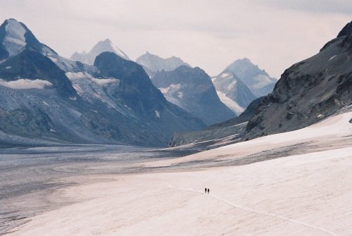 High Alps, Switzerland
.........................................
Extreme Cold To Grip Europe. Forecast -38°C in Switzerland…Will Be Even Colder Later…Pattern Not Seen in 70 Years.
By P Gosselin on 22. November 2010
........................
Britain faces commuter chaos as temperatures hit -17C in coldest November since 1985....................................................................... Wintry weather grips Britain ................................................. msnbc.com updated 11/28/2010 12:07:41 AM ET
Most widespread snow in 17 years; UK residents urged to stay indoors ....................
Mary008
|
||
|
||
|
Mary008
V.I.P. Member
Joined: June 22 2009 Status: Offline Points: 5769 |
Post Options
Thanks(0)
Quote Reply
Posted: November 28 2010 at 4:48pm |
|
|
.
Cold now thru... Dec.... moderate later ( the Heart of Winter )
Hey Europe, the Arctic Hound Is Getting Ready to Howl! ............................................................................................ ........................
Mary008
|
||
|
||
|
Mary008
V.I.P. Member
Joined: June 22 2009 Status: Offline Points: 5769 |
Post Options
Thanks(0)
Quote Reply
Posted: November 29 2010 at 7:48pm |
|
|
.
A good read.
The truth about global warming
.......................................................... By Sandi Doughton
Seattle Times staff reporter
Tuesday, October 11, 2005 ...More than a decade later, Wallace still won't blame global warming for any specific heat wave, drought or flood - including the recent devastating hurricanes. But he no longer doubts the problem is real and the risks profound.
...................
Cancun climate change summit:
scientists call for rationing in developed world ................................................................................ Unless emissions are reduced dramatically in the next ten years
......................................................................................................... the world is set to see temperatures rise by more than 4C (7.2F) by as early as the 2060s, causing floods, droughts and mass migration. Temperature records to be made public
.................................................................... Climate scientists are to publish the largest ever collection of temperature records, dating back more than a hundred years, in an attempt to provide a more accurate picture of climate change.
Copenhagen climate summit: Ed Miliband admits failures ................................................................................................. VIDEO Ed Miliband, the Environment Secretary, has admitted that the Copenhagen climate summit
failed to achieve what had been hoped for.
..............................
Mary008
|
||
|
||
|
Mary008
V.I.P. Member
Joined: June 22 2009 Status: Offline Points: 5769 |
Post Options
Thanks(0)
Quote Reply
Posted: November 29 2010 at 9:36pm |
|
|
.
Mississippi... Tornado Watch
.........................................................
ississippi+State+MS&product1=Tornado+Watch
...................................
Mary008
|
||
|
||
|
Mary008
V.I.P. Member
Joined: June 22 2009 Status: Offline Points: 5769 |
Post Options
Thanks(0)
Quote Reply
Posted: December 01 2010 at 10:33am |
|
|
.
Melting is real
..............................
They are in a desperate situation," said Antonio Lima, ambassador to the UN for the Cape Verde Islands, off the west coast of Africa. "All of us face disaster. We don't want to be the forgotten, the sacrificed countries of the 21st century," he said.The 43 have flatly rejected suggestions by rich countries that they could use adaptation money to build sea defences and say they cannot compromise on their position that the world must seek to hold temperatures to no more than a 1.5C rise rather than the 2C now proposed by Britain, Europe and the US. from-
Don't consign us to history, plead island states at Cancun........................................................................................................................................ At Cancun climate talks, diplomats from 43 island nations say they face 'the end of history'
unless action is taken to stop sea levels rising
VIDEO
......................
Mary008
|
||
|
||
|
Mary008
V.I.P. Member
Joined: June 22 2009 Status: Offline Points: 5769 |
Post Options
Thanks(0)
Quote Reply
Posted: December 03 2010 at 9:56pm |
|
|
.
Europe's deadly cold snap maintains grip
.......................................................................................... 3 December 2010 L
ast updated at 19:44 ET VIDEO
............................................
Mary008
|
||
|
||
|
Mary008
V.I.P. Member
Joined: June 22 2009 Status: Offline Points: 5769 |
Post Options
Thanks(0)
Quote Reply
Posted: December 03 2010 at 10:02pm |
|
|
OOPS...
The United States and South Korea have reached a new free trade deal, the largest Washington trade deal since the 1994 North American Free Trade Agreement (NAFTA).
http://www.presstv.ir/detail/153797.html .........................Mary008
|
||
|
||
|
Mary008
V.I.P. Member
Joined: June 22 2009 Status: Offline Points: 5769 |
Post Options
Thanks(0)
Quote Reply
Posted: December 05 2010 at 9:44am |
|
|
.
Britain braced for the return of the big freeze:
Temperatures down to -15C tonight (and chaos will last for two weeks)
..................................
Mary008
|
||
|
||
|
Mary008
V.I.P. Member
Joined: June 22 2009 Status: Offline Points: 5769 |
Post Options
Thanks(0)
Quote Reply
Posted: December 05 2010 at 11:56am |
|
|
.
May 2010
U.S. Scientists Urge Action On Climate ChangeListen Here-
...........................
Mary008
|
||
|
||
|
Mary008
V.I.P. Member
Joined: June 22 2009 Status: Offline Points: 5769 |
Post Options
Thanks(0)
Quote Reply
Posted: December 07 2010 at 9:46pm |
|
|
.
South Florida braces for the cold
............................................................... South Florida is bracing for a stronger than usual cold snap that will send temperatures
Tuesday and Wednesday into the 30s.
Donations needed at cold weather shelters ........................................................................... FORT MYERS
...in desperate need of blankets, men's coats and hats, plus gloves for teens.
Video .........................
Mary008
|
||
|
||
|
Mary008
V.I.P. Member
Joined: June 22 2009 Status: Offline Points: 5769 |
Post Options
Thanks(0)
Quote Reply
Posted: December 12 2010 at 10:13am |
|
|
.
Crazy Weather
............................
Storms bring flood threat to Wash., Ore. rivers............................................................................................................... Heavy rains in the Pacific Northwest have triggered mudslides as they swell rivers and place small towns in Washington and areas of Portland under flood threat.
The Associated Press .html
-
MUDSLIDE
..................
CNN
............
Amtrak shuts down Washington-Oregon route after mudslide hits tracksFrom Leslie Tripp and Greg Morrison, CNN cnnAuthor = "From Leslie Tripp and Greg Morrison, CNN";
'December 12, 2010 6:14 a.m. EST');} December 12, 2010 6:14 a.m. EST
.......................
Pennsylvania
December 2010 Flooding
VIDEO
Wallis Run and Little Bear Creek rage
VIDEO
Lycoming County, Pennsylvania
Don't drive on flooded roads
VIDEO
Decenber 2010
.............................
State College Flooding 12/1
Ithaca NY Floods
VIDEO
Floods devastate South America
5 days ago...
Video
Terrible rains in september this yr....
Mad Mudslide: Video of cars, houses drowning in mud in Italy
September 10, 2010
Video
one month ago...
At least 20 dead in Peru mudslides
Video
Mexico: 500 people believed dead in Santa Maria Tlahuitoltepec
September 29, 2010
October 2010
Floods on Greek Aegean Sea
Video
..........................
Mary008 |
||
|
||
|
Mary008
V.I.P. Member
Joined: June 22 2009 Status: Offline Points: 5769 |
Post Options
Thanks(0)
Quote Reply
Posted: December 12 2010 at 9:50pm |
|
|
.
This is a wonderful Map put out by NOAA
....................................................................
click on any area for very detailed weather info.
..........................
Mary008
|
||
|
||
|
Mary008
V.I.P. Member
Joined: June 22 2009 Status: Offline Points: 5769 |
Post Options
Thanks(0)
Quote Reply
Posted: December 13 2010 at 10:08pm |
|
|
.
Another Dose of Frigid Air..................................................................... by Chris Dolce, Meteorologist
...This is allowing temperatures to fall 10 to 30 degrees below average
to kick off the new week.
.................
Mary008 |
||
|
||
|
Mary008
V.I.P. Member
Joined: June 22 2009 Status: Offline Points: 5769 |
Post Options
Thanks(0)
Quote Reply
Posted: December 15 2010 at 7:11pm |
|
|
.
CDC
........
Extreme Cold: A Prevention Guide to Promote Your Personal Health and Safety...............................
Mary008
|
||
|
||
|
Mary008
V.I.P. Member
Joined: June 22 2009 Status: Offline Points: 5769 |
Post Options
Thanks(0)
Quote Reply
Posted: December 16 2010 at 9:03am |
|
|
.
Arctic Blast Chills 30 States Dangerous cold weather
stretches from the Midwest to the Deep South.
............................................................................................
12/14/2010 Video .........................................
Mary008
|
||
|
||
|
Mary008
V.I.P. Member
Joined: June 22 2009 Status: Offline Points: 5769 |
Post Options
Thanks(0)
Quote Reply
Posted: December 16 2010 at 10:01pm |
|
|
.
sounds like a jet is sitting in their driveway... Orkney blizzards start again
...................................................... 13 hours ago
............................
Mary008
|
||
|
||
|
Mary008
V.I.P. Member
Joined: June 22 2009 Status: Offline Points: 5769 |
Post Options
Thanks(0)
Quote Reply
Posted: December 17 2010 at 8:50pm |
|
|
.
WEATHER
.....................
Joe Bastardi European Blog
................................................... ............................
Mary008 |
||
|
||
|
Mary008
V.I.P. Member
Joined: June 22 2009 Status: Offline Points: 5769 |
Post Options
Thanks(0)
Quote Reply
Posted: December 20 2010 at 7:36pm |
|
|
Severe weather crowds European airports with frustrated passengers
.................................................................................................................................................
...............................
Mary008
|
||
|
||
|
Mary008
V.I.P. Member
Joined: June 22 2009 Status: Offline Points: 5769 |
Post Options
Thanks(0)
Quote Reply
Posted: February 03 2011 at 3:30pm |
|
|
World of two halves! Map shows most of Northern Hemisphere is covered in snow and ice .............................................................................................................. By Daily Mail Reporter Last updated at 11:00 AM on 3rd February 2011 Scroll down for great pics... and video report at the bottom... http://www.dailymail.co.uk/news/article-1353073/Winter-storm-Map-shows-Northern-Hemisphere-covered-snow-ice.html ..................................... Mary008 |
||
|
||
|
quickdraw
Adviser Group

Joined: August 10 2006 Status: Offline Points: 219 |
Post Options
Thanks(0)
Quote Reply
Posted: February 25 2011 at 9:46am |
|
|
What a waste of time Mary, no usefull info at all.
|
||
|
Everyday is a good day and if you dont believe that try missing one.
|
||
|
||
|
jacksdad
Executive Admin

Joined: September 08 2007 Location: San Diego Status: Offline Points: 47251 |
Post Options
Thanks(0)
Quote Reply
Posted: February 27 2011 at 9:34pm |
|
|
Thanks for posting all that Mary. Very informative

|
||
|
"Buy it cheap. Stack it deep"
"Any community that fails to prepare, with the expectation that the federal government will come to the rescue, will be tragically wrong." Michael Leavitt, HHS Secretary. |
||
|
||
|
quickdraw
Adviser Group
Joined: August 10 2006 Status: Offline Points: 219 |
Post Options
Thanks(0)
Quote Reply
Posted: March 01 2011 at 3:00pm |
|
|
What did you get out of that.
|
||
|
Everyday is a good day and if you dont believe that try missing one.
|
||
|
||
|
jacksdad
Executive Admin
Joined: September 08 2007 Location: San Diego Status: Offline Points: 47251 |
Post Options
Thanks(0)
Quote Reply
Posted: March 02 2011 at 6:58am |
|
|
Three pages of info and links. Thanks again for taking the time, Mary.
|
||
|
"Buy it cheap. Stack it deep"
"Any community that fails to prepare, with the expectation that the federal government will come to the rescue, will be tragically wrong." Michael Leavitt, HHS Secretary. |
||
|
||
|
Post Reply
|
|
 Tweet
Tweet
|
| Forum Jump | Forum Permissions You cannot post new topics in this forum You cannot reply to topics in this forum You cannot delete your posts in this forum You cannot edit your posts in this forum You cannot create polls in this forum You can vote in polls in this forum |


 Say About The Weather?")


 Topic Options
